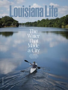
Bayou St. John: The Water That Made a City
New Orleans has always told its oldest story on the banks of Bayou St. John.
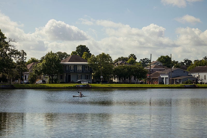
Stand at the edge of Bayou St. John on a quiet morning and the city seems to fall away. The water shifts through several faces in a single day — steam rising from the surface as temperatures change at dawn, the glassy stillness of midday broken only by a turtle retreating from a log, the shimmer of moonlight on the water after dark. For Kristal Huggins, a biology instructor at Xavier University of Louisiana and a longtime steward of the waterway, walking up to the bayou as a child was an experience she still reaches for to describe what this place is all about.
“Growing up and visiting Bayou St. John, I mostly remember the thick vegetation, and walking up to a clearing was like having another world revealed to me,” Huggins says. “I could see what seemed to be a giant river with lots of birds — ducks, geese, egrets — and, of course, turtles, too. It was an escape from the city buildings and concrete.”

This stereographic image by Theodore Lilienthal was taken in 1866. It shows the foot bridge across Bayou St. John, looking from Moss Street toward modern City Park Avenue. (The William Russell Jazz Collection at the Historic New Orleans Collection, acquisition made possible by the Clarisse Claiborne Grima Fund, MSS 520.1118)
That quality of escape — the sense of a natural world existing at the heart of a major American city — is not accidental. Bayou St. John is, as author and historian Cassie Pruyn puts it, “literally and symbolically a little thread of history running through the heart of the city.” Her 2017 book, “Bayou St. John: A Brief History,” remains the definitive popular history of the waterway, and its central argument is one she makes without hesitation — that the bayou is why New Orleans exists where it does.
“The bayou was integral to the founding of New Orleans by the French over 300 years ago precisely because small waterways like the bayou served as transportation channels for indigenous communities who inhabited this watery region for centuries prior to the arrival of Europeans,” Pruyn says. “Native people showed the French colonists how to bypass the treacherous mouth of the Mississippi River by traveling to its shore via a backdoor route from the Gulf, into Lake Pontchartrain, down Bayou St. John and over a portage route to the edge of the river around the present-day French Quarter.”

This photograph taken by Morgan Whitney between 1880 and 1910 shows Pitot House before its move and restoration in 1964. In order to save it from demolition, the home’s second floor and plastered brick columns were carefully moved approximately 200 feet and a new foundation and first floor were constructed at its current location, 1440 Moss Street. (Historic New Orleans Collection, gift of Morgan Whitney, 1974.63.30)
That portage — the overland trail between the bayou’s headwaters and the Mississippi — would eventually become Bayou Road, and later Esplanade Avenue, one of the city’s grandest corridors. The settlement that grew up around the bayou, Port Bayou Saint-Jean, predates the official founding of New Orleans in 1718 by a full decade.

Across the bayou stands the Pitot House in its current location. Today, both banks of the bayou serve as popular gathering spots where people and their pets come to stroll, relax and enjoy the scenery.
A House That Holds History
At 1440 Moss Street, where the bayou’s western bank curves south toward Esplanade Avenue, the Pitot House has stood since 1799. It’s the only Creole colonial country house in New Orleans open to the public, and its story is, in miniature, the story of the city itself.
Stacey Pfingsten, executive director of Louisiana Landmarks Society, which owns and operates the Pitot House, says the building’s significance was immediately apparent to her. “I knew the Pitot House was special just by looking at it, as we have very few West Indies-style houses in the entire state of Louisiana,” she says. “Only three remain in that style, and the Pitot House is the only one open to the public.”
The style, as longtime docent Jamie Barker explains, was built entirely around the realities of life in this climate. “Pitot House is a lovely and practically designed home for life in the hot, humid climates of the islands of the Caribbean Sea — and the similar climate of New Orleans,” she says. “It is open-aired with no central hallways and doors. All windows, transoms, doors and shutters are designed to be opened to keep residents as cool as possible in the heat. It’s like living outside with protection from rain.”
The house passed through a remarkable succession of owners. It was completed by Marie Tronquet Rillieux — the great-grandmother of French Impressionist painter Edgar Degas — before being purchased in 1810 by James Pitot, the first American mayor of New Orleans following the Louisiana Purchase. Pitot also served as president of the Orleans Navigation Company, which managed boat traffic on the bayou visible from his own front gallery.
“It makes the relationship feel very direct,” Pfingsten says. “It shows how small and connected the early city was. One person could be shaping policy and also keeping an eye on what was moving along the bayou. Everything was right there, and you could see the impact of decisions in real time.”
Later, the house was acquired by Mother Frances Xavier Cabrini, who would become the first American citizen canonized as a Roman Catholic saint. In 1964, when the building faced demolition to make way for a school expansion, the Louisiana Landmarks Society moved it 220 feet down Moss Street on flatbed trucks to save it.
“The move also clarified what, exactly, people were trying to save,” Pfingsten says. “Not just a footprint on a map, but the building itself. It also reflects a time when preservation wasn’t so formalized. People were going on instinct more than policy. It wasn’t perfect, but it worked. And that’s why the house is still here.”
Standing on the Pitot House’s upper gallery, Barker says, visitors are often stopped by the view — and by what that view once held. “In those earlier years in the 1800s, it would have been a viable waterway — wider and with boat traffic, since it was used during the earlier years as an easier route into the city,” she says. The Carondelet Canal, hand-dug in 1794, extended the bayou’s navigable reach toward the French Quarter. By the late 19th and early 20th centuries, that commercial era had faded. “By the 20th century, the bayou was no longer ‘useful’ commercially,” Barker adds. “But the bayou would have been just as lovely as it is today.”

Things to Do Around Bayou St. John
More than a scenic spot, Bayou St. John is a favorite gathering space. If you’re looking for a little exercise, rent a kayak for the day and paddle along the bayou. The grassy banks are also the ideal spot for picnics, celebrations or reunions. If you’re looking for a slower pace, wander over to the Sydney and Walda Besthoff Sculpture Garden or spread out a blanket, bring some snacks and have a picnic next to the water.

Historic New Orleans Collection, gift of Samuel Wilson Jr., 1981.328.59; The William Russell Jazz Collection at the Historic New Orleans Collection, acquisition made possible by the Clarisse Claiborne Grima Fund, MSS 520.1118

These two images show the Evariste Blanc House, now the rectory for Holy Rosary Catholic Church. The first dates to 1886–1895, and the second to 1956. Built in 1834 as a Greek Revival mansion on Bayou St. John, the home was donated to establish Our Lady of the Rosary Parish and became the parish rectory in 1907 — a role it continues to serve today.
What the Water Holds
The New Orleans Museum of Art rises at the eastern edge of City Park, directly across from the bayou. Its director, Susan M. Taylor, describes NOMA’s location as a unique vantage point at an intersection of cultural and natural resources. The museum’s free Sydney and Walda Besthoff Sculpture Garden, which comprises 12 acres and nearly 100 works of art, and is open seven days per week, was designed with the Louisiana landscape in mind.
“Our Louisiana landscape and the sculptures’ relationship to the natural environment are what set the Besthoff Sculpture Garden apart from other destinations,” Taylor says. “The selection of native species in the landscape reflects a deliberate choice to connect the Louisiana landscape to works of art that sit in that landscape. The result is an experience that unfolds as you make your way through the garden. It is truly where art and nature meet.”

The Dufour-Plassan House was built in 1870 by former state senator and district attorney Cyprien Dufour on Esplanade Avenue. It was moved to its current location in 1906 when it was purchased by Adolph Plassan. Its ornate iron fence, featuring cornstalks, sunflowers and fruit motifs, was crafted by Wood, Miltenberger & Co. and would have been at the time a striking display of wealth. The landmark home remains a private residence today.
The 2019 expansion of the garden was designed specifically with water stewardship in mind. “There is a unique system of weirs and landscape components to prevent flooding, as well as an emphasis on native plants, which reflect and support the larger ecology of the area,” Taylor says. It’s an ecology that connects directly to Bayou St. John’s own watershed.
Among NOMA’s permanent collection holdings is “Portrait of Estelle Musson Degas,” painted by Edgar Degas during his 1872-73 visit to New Orleans. The painting’s acquisition in 1965 came through a community fundraising campaign wherein individuals and schoolchildren donated small amounts toward the purchase. “It was a crowdfunding campaign before their recent popularity, showing the sense of pride people have in museums,” Taylor says.
The Bayou by the Numbers
Length
Less than 5 miles
Average Width
Approximately 200 feet
Maximum Depth
Approximately 9 feet
Neighborhoods Bordered
Seven
Wisner Bike Path
4.7 miles
Oldest Artifacts Found Nearby
Approximately 300-400 A.D.
Native Name
Bayou Choupic
What the Name Means
Mudfish Bayou

A City Defined by Water
For Jared Zeller, founder and interim executive director of Friends of Bayou St. John, the waterway’s significance is both historical and urgently present. He founded the Mid-City Bayou Boogaloo festival in 2006 — the first event held in the aftermath of Hurricane Katrina — after watching the storm’s devastation unfold from a distance. It was, he said, watching a helicopter crash on the bayou’s banks during rescue efforts that galvanized him to act.
“My intention was to do something positive for a community in peril — and that included my own personal experience, as my home was flooded also,” Zeller says. “After the first event, the response was so positive and so well received by the community, I knew we had something special.”


Tucked just off Esplanade Avenue in Bayou St. John, 1000 Figs serves a falafel platter featuring hummus, kale and cabbage salad, toum, tahini, zhoug and house-made bread.
The festival grew from a scrappy post-Katrina gathering into a beloved annual celebration. But for Zeller, the Boogaloo has always been a means, not an end. “Ultimately, the Bayou Boogaloo is a vehicle to promote and create mindshare for Bayou St. John in our community, highlighting its historical significance, its place as a unique urban waterway and its transformation as an important trading route during exploration days to industrial use during WWII, and now mostly recreational,” he says.
Friends of Bayou St. John has commissioned a long-term visioning study for the waterway’s future, and Zeller’s questions for that study are pointed: Can the water quality be improved? Can rough concrete edges be replaced with natural shorelines? Can the bayou be used to teach young people its history and the species that live in and around it?


Located just a block from Bayou St. John on Hagan Avenue, Parkway Bakery & Tavern has been a New Orleans institution since 1911.
“It’s unique,” Zeller says. “It may be the only urban bayou. Many residents feel a sense of ownership. Certainly, one could argue it has been protected due to the limited development along Bayou St. John, which maintains a lot of the natural beauty.”
That ownership is something Huggins has spent years nurturing through ecological stewardship and volunteer work. During a cleanup event in 2019, her team discovered something alarming in the bayou’s waters — the first known reproducing population of the Asian swamp eel (Monopterus albus) in North America. “After grabbing one, I realized it had no snake characteristics except for body shape, but I had never seen anything like this before in our brackish waterway,” Huggins says. The implications were immediately clear. The bayou connects to the City Park lagoons and Lake Pontchartrain, and an invasive species established here has a pathway to spread through Louisiana’s entire interconnected waterway system.

This image from ca. 1895 shows the Magnolia Bridge. The hand-cranked swivel bridge was built in the late 1800s when Bayou St. John was still in use as a commercial waterway. In 1908-1909, the bridge was moved about a quarter mile from its original location at Esplanade Avenue to Harding Street. (Historic New Orleans Collection, 1974.25.39.151)
But Huggins remains steadfast. “I truly feel optimistic about the future of Bayou St. John,” she says. “Over the years, I have witnessed the bayou visibly become cleaner. I see more patches of native plants popping back up after a winter of dormancy, I hear more concern over the general health of the bayou, and I see more people taking action.”
Pruyn, who has spent years with this waterway, sees it now in layers invisible to the casual visitor. “I see ghostly layers of the past laid over the modern bayou like a see-through timelapse montage, and I love it,” she says. “In my mind’s eye, ancient canoes and giant schooners slide by. I see pleasure gardens and rowing races and old bridges and Higgins boats.”
Nine years after her book was published, Pruyn says the bayou’s lessons feel more urgent than ever, and more universal. “New Orleans has always been defined — in a uniquely direct way — by water,” she says. “But now, with rising sea levels and increasingly extreme weather events, New Orleans just isn’t that unique anymore when it comes to water being where we don’t want it to be. Wouldn’t it be incredible if, due to its historical relationship to water, New Orleans could inspire the wider world to rethink and reframe that relationship, much as the Dutch have done?”
The bayou moves through the city slowly, as it always has. It has been a trade route, a military outpost, a commercial corridor, a ceremonial ground and a neighborhood park. It has been drained and filled and revived. It has been nearly lost and stubbornly found again.
“I don’t see how we can allow, as a community, any entity to not protect and celebrate what inherently is part of who we are,” Huggins says. “Bayou St. John is part of our future.”

Where to Eat Around Bayou St. John
Several restaurants are scattered around the bayou, offering a range of options. Spanish flavors abound at Lola’s, where they have tapas, paella and sangria on the menu. For a lighter option, 1000 Figs serves delicious Mediterranean dishes and has become a neighborhood staple. A long-time local favorite, Parkway Bakery and Tavern brings crowds in for their famous po’boys. If you’re craving a fine dining experience, Ralph’s on the Park, just across from City Park, has beautiful views and contemporary Creole cuisine.


Where to Have a Drink Around Bayou St. John
Whether you’re looking for a cool beer on a hot day or a place to gather after Jazz Fest, Bayou St. John has some of the city’s favorite spots to have a drink. Bayou Beer Garden pairs patio seating with an extensive beer selection. Within walking distance from the bayou, Pal’s Lounge is an unpretentious neighborhood bar with tasty cocktails and a welcoming vibe. Wrong Iron on the Greenway offers a spacious outdoor area, frozen drinks, and is dog-friendly too. These are just a few, but they reflect the area’s relaxed, community-centered attitude.